
Hardware-Software Integration, Industrial Automation & Deep Learning Projects
Browse a portfolio of applied engineering work combining camera control software, industrial automation, and deep learning. Every project below is a working system built to tackle a genuine measurement, classification, or imaging problem.
Applied Research & Systems
Control Software for Color and 3D Profiling Cameras
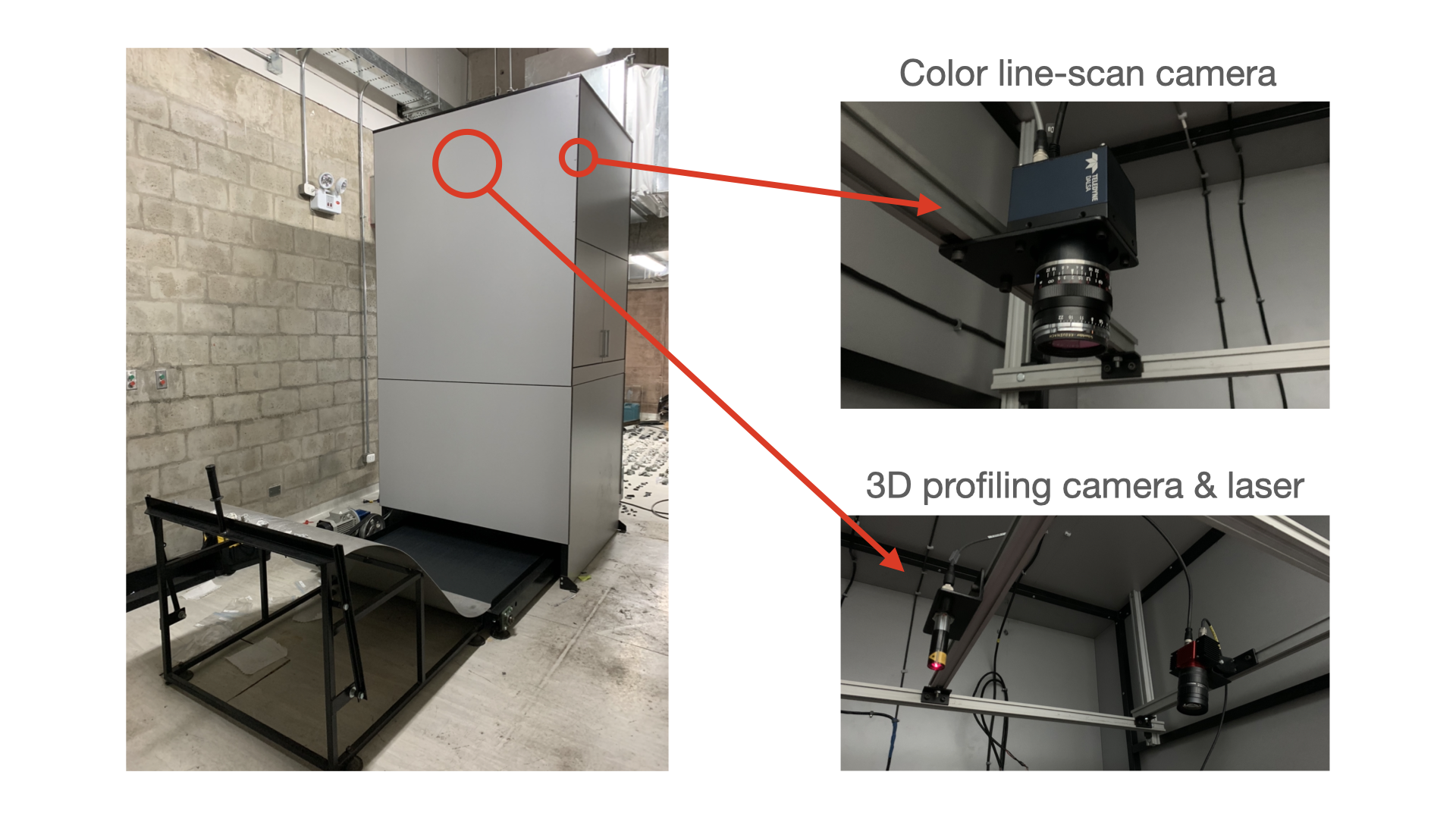
Hugo Negreyros and David Shatwell built software that controls and synchronizes two Gigabit Ethernet cameras simultaneously: a Teledyne Dalsa Spyder 3 color camera and an Automation Technology C2-2040 3D profiling camera. The setup enables high-speed characterization of materials traveling along a conveyor belt.
CodeOre Sorting using Color and Hyperspectral Imaging
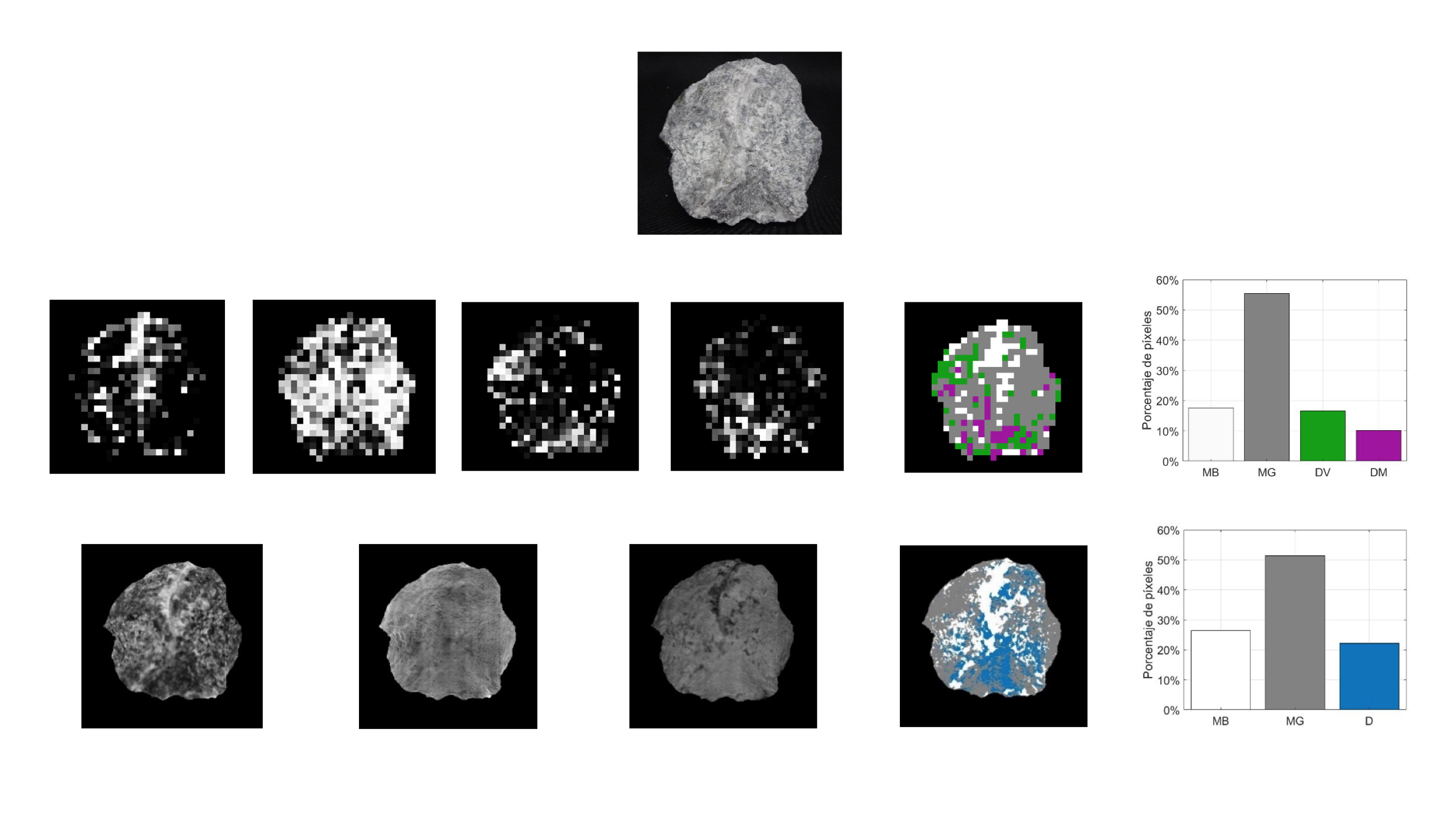
David Shatwell, Victor Murray, and Augusto Barton developed an autonomous method that combines color, texture, and hyperspectral features to classify mineralized rock. The work reached an MCC of 0.9787 and was selected as one of 25 finalists at the PERUMIN 35 National Mining Contest.
Classification of Satellite Images based on their Class of Terrain
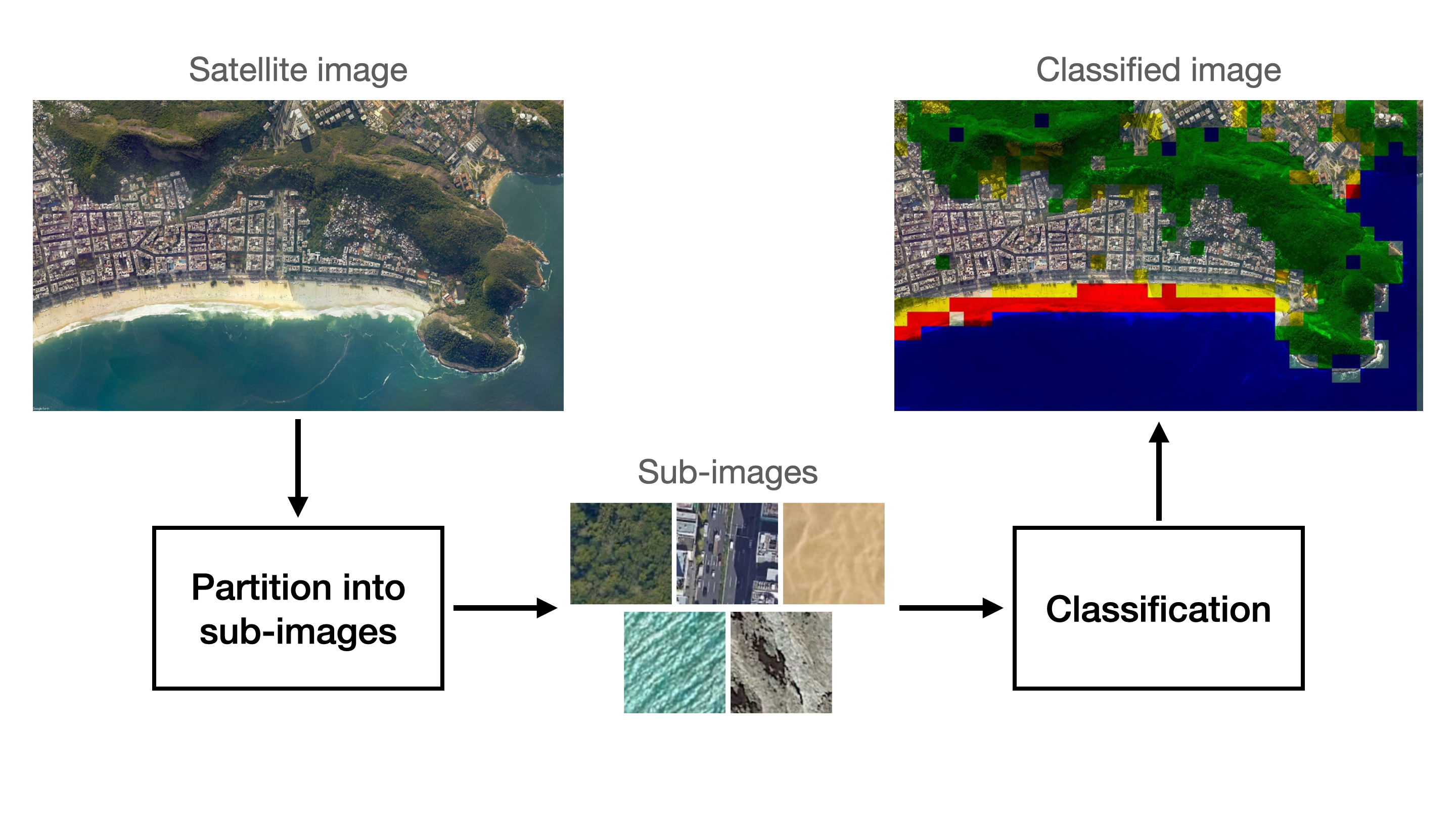
David Shatwell, Alejandro Weston, and Oscar Ramos created a terrain classification system that separates five classes — city, sand, vegetation, mountain, and water — by pairing deep convolutional architectures with classical feature classifiers on Google Earth imagery.
CodeAnthropometric Measurements Estimation using OpenPose Algorithm
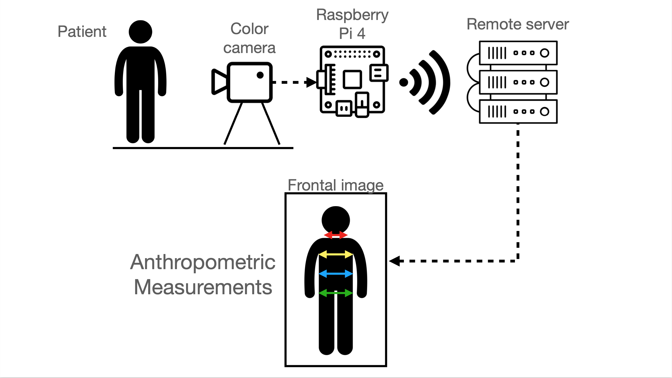
David Shatwell designed an automated medical triage system that relies on OpenPose body keypoint coordinates to estimate frontal projections and body circumferences for clinical occupational screening.
CodeFrequently Asked Questions
© 2026 David Shatwell
Each project on this page reflects a hands-on approach to solving real engineering problems, from synchronizing industrial cameras to applying deep learning for classification and measurement. Use the Code buttons to explore the public repositories, or visit the Papers and GitHub pages for related research and additional work.